Evaluating the impact of low-traffic neighbourhoods
Assisting local authorities with data-driven decision-making.
The challenge
As part of the Oxford Local Cycling and Walking Infrastructure Plan (LCWIP), Oxfordshire County Council has implemented Low-Traffic Neighbourhoods (LTNs) in two areas of Oxford: Cowley and East Oxford.
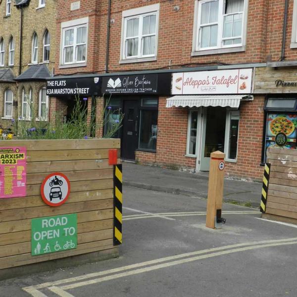
An LTN is a residential area where closures prevent motorised traffic from taking shortcuts. LTNs use physical closures such as planters and bollards or enforcement using automatic number plate recognition (ANPR). This creates quieter and safer streets where residents may feel more comfortable when making local journeys by cycling, wheeling, or on foot. All roads remain accessible, but drivers may have to find alternative routes instead of cutting through some streets.
Following public consultation, the county council implemented the LTN schemes in Cowley and East Oxford through Experimental Traffic Regulation Orders (ETROs). ETROs are used when it is difficult to assess a scheme's impacts beforehand, but the cost of implementation is relatively low.
The experimental phase allowed residents, businesses, and other interested parties to see the scheme's impact in their neighbourhood. The council can monitor:
- traffic flows
- air quality
- changes in people's perception
- shifts in their mode of travel
The solution
We delivered a series of comprehensive and in-depth evaluations on the low-traffic neighbourhoods, assessing the impacts of the schemes within and near the LTN areas. The post-Covid period context of the scheme implementation was a confounding factor; it would have been impossible to disaggregate the impact of Covid lockdowns and recovery from the effects of the scheme in a straightforward before and after evaluation. We leveraged several data sources in the impact area as well as control sites, including:
- object identification sensors
- bus and vehicle telematics
- noise and air quality sensors
We analysed these using a 'difference in difference' approach to remove other factors and build a robust evaluation that focused on the impact of the LTN schemes. For East Oxford, these evaluations included:
The results
Following an 18-month trial, the county council's cabinet decided in a meeting on 19 July 2022 that the Cowley low-traffic neighbourhoods would remain in place. The evaluations we produced, alongside other evidence, informed the decision.
The council committed to undertaking additional community and stakeholder engagement to refine the scheme further, including a consultation on the use of automatic number plate recognition (ANPR) cameras in spring 2023.
The experimental trial of the east Oxford low-traffic neighbourhoods ran from May 2022 to November 2023. An informal public consultation on the scheme (for the ETRO) was open from 20 May until 30 November 2022, followed by a formal consultation between 5 June and 20 July 2023 (for the TRO). The county council's cabinet decided at a meeting on 17 October 2023 that the east Oxford LTNs would remain, informed by the evaluations produced by Innovate Oxfordshire alongside other evidence.
